

Date of Award
2024
Document Type
Thesis
Handle
https://hdl.handle.net/10365/33849
Publisher
North Dakota State University
Rights
NDSU policy 190.6.2
URI
https://www.ndsu.edu/fileadmin/policy/190.pdf
Abstract
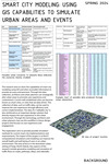
This research aims to show the capabilities of smart city modeling using GIS and other accessible information to provide accuracy and precision. Through this data collection, architects and urban planners can strategically alter urban areas to promote user experience and contentment. Current well-established cities can become known as smart cities, or cities that are data driven. This collection of data, such as traffic data, can be used to improve the user experience through efficiency and correct implementation. The idea of a “walkable city” is also reinforced as an important design solution that directly impacts the user experience in this urban environment. Through this technology, architects and urban planners may use this workflow in future design projects that focuses on user experience and engagement. This exploration aims to provide possible simulation methods for current smart city implementations and improvements. The impact of this project is to find if computational simulations and modeling can improve the overall health and well-being of users in an urban environment. The area of focus in the downtown urban setting of Fargo, North Dakota. Key aspects of this research include generative modeling and simulation of traffic flows on roads, pathways, alleys, and sidewalks.
Recommended Citation
Crawford, Zachary Isaac, "Smart City Modeling: Using GIS Capabilities to Simulate Urban Areas and Events" (2024). Architecture Theses. 539.
https://digitalcommons.ndsu.edu/architecture-theses/539