









-

Prairie Haven: Combating Urban Sprawl With Ecological Landscape Assemblage in Forest Lake, Minnesota
Ryan Anthony Calhoun
Contemporary residential developments frequently default to sprawl, creating fragmented environments that lack both environmental resilience and authentic human interconnection. This thesis explores how landscape architects can utilize Assemblage Theory to design residential developments where sustainable materials, ecological systems, and social elements dynamically assemble to create a meaningful, human-scaled sense-of-place. By synthesizing the structural planning efficiency of New Urbanism, the ecological imperatives of Landscape Urbanism, and the metrics-driven performance of Ecological Urbanism, this research develops a hybridized operational approach to residential development. Applied to a master plan in Forest Lake, Minnesota, the design for “Prairie Haven” demonstrates how treating a neighborhood as a socio-material network allows for an adaptable, living master plan. This approach effectively bridges the gap between structured urban design and fluid ecological processes, offering a robust, multidimensional model for creating resilient community developments.
-
Climate-Adaptive Urban Arboretum: Designing Tree Diversity and Landscape Resilience Against Climate-Related Tree Diseases in Fargo, North Dakota
Rojin Ghafori Dehgolan
This thesis explores how climate change may influence the severity of Oak Wilt Disease and Dutch Elm Disease in Fargo, North Dakota, and how landscape design can respond to future urban forest health challenges. Urban trees are essential components of green landscapes because they provide shade, aesthetic value, ecological benefits, and social comfort. However, climate change is altering environmental conditions such as temperature, precipitation, soil moisture, humidity, drought, and flooding, all of which can influence plant disease development. This research focuses on two major tree diseases: Oak Wilt Disease, caused by Bretziella fagacearum, and Dutch Elm Disease, caused by Ophiostoma ulmi and Ophiostoma novo-ulmi. Both diseases are influenced by interactions among host trees, pathogens, insect vectors, and environmental conditions. Using a review-based research method, this study examines scientific literature, Fargo tree canopy data, and climate data related to temperature and precipitation trends in North Dakota. The research identifies how warming temperatures, increased precipitation events, and changing insect vector activity may increase disease pressure on elm and oak trees in Fargo’s urban forest. The findings suggest that future climate conditions may create more favorable conditions for disease development and spread, especially if urban tree composition remains limited or overly dependent on vulnerable species. Therefore, increasing tree diversity, improving species distribution, and designing climate-adaptive landscapes are essential strategies for long-term urban forest resilience. The design application translates these research findings into a landscape proposal that promotes tree diversity, ecological resilience, and public education. The project incorporates an arboretum, diverse deciduous and evergreen tree plantings, bioswales, rain gardens, water features, and social gathering spaces. Together, these design strategies create a resilient, educational, and community-centered landscape that responds to climate change while supporting the health and longevity of Fargo’s urban forest.
-
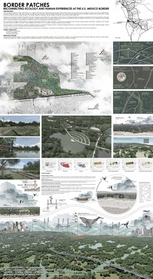
Border Patches: Reconnecting Ecology and Human Experiences at the U.S.-Mexico Border
Shima Goodarzi
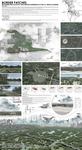
International borders are among the most engineered and ecologically fragmented landscapes in the world. Along the U.S.-Mexico border, infrastructure systems such as walls, patrol roads, and cleared enforcement zones have disrupted wildlife movement, fragmented habitats, altered hydrological systems, and limited social interaction between neighboring communities.
This thesis develops a digital environmental twin framework to evaluate ecological and social connectivity within the San Diego-Tijuana border region. Using ArcGIS Pro and ArcGIS Urban, spatial datasets including land cover, habitat suitability, hydrology, circulation networks, and urban density were analyzed to identify areas with high ecological potential and opportunities for intervention.
The research informed a site-specific landscape architecture proposal within a 1,400-acre border landscape at San Ysidro-Tijuana. The design reimagines the border as a layered ecological and social infrastructure through habitat restoration, wildlife corridors, wetlands, elevated circulation systems, and controlled cross-border gathering spaces.
Together, the research and design demonstrate how digital environmental tools can support evidence-based landscape strategies that restore connectivity, strengthen biodiversity, and create new forms of interaction within fragmented border environments.
-
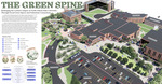
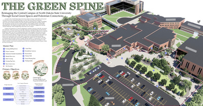
The Green Spine: Reimagining the Central Campus of North Dakota State University Through Social Green Spaces and Pedestrian Connections
Lydia Ham
This thesis studies how landscape architecture can reimagine university campuses as connected, flexible, and functional environments that enhance how people will interact with the outdoor environment. Focusing on North Dakota State University in Fargo, North Dakota, the project focuses on adding green space where there are currently underutilized open spaces. Key principles of successful campus landscapes focus on including well defined circulation systems, spatial variety, and multifunctional use. Where research has developed three focus zones including Bison Green, Prairie Common, and Herd Crossing to show how integrated landscape systems can support movement, learning, and recreation while still maintaining an overall campus identity.
-

Forging Resiliency: Designing for Wildfire Defenses in the Pyrocene Age in Paradise, California
Rebecca Anne Heide
Wildfires are becoming larger, hotter, and more destructive. California has been strongly impacted by large-scale wildfire disasters, with a number of fires in recent history resulting in significant loss of life and infrastructure. The Camp Fire, which destroyed over 85% of the town of Paradise, California in 2018, is one such event. Landscape architecture is a discipline uniquely positioned to address wildfire disaster resilience. This project uses case studies and ArcGIS data to reimagine a 1,600-acre site directly East of the town of Paradise, California. By using a multi-layered wildfire management strategy that uses the principles of resist, co-create, and retreat. The goal of the resulting design is to be used as a template, that can be scaled to create a community-wide defense strategy.
-
Green Space Behind Bars: Designing for Resident Wellbeing at the Heart River Correctional Center Near Mandan, ND
Kaja Holtz
This design thesis reimagines the environment of the Heart River Correctional Center by transforming the outdoor space into a therapeutic space for resident wellbeing. The current environments of minimum security correctional centers in the United States, focuses heavily on security and control without the emphasis on rehabilitation and reentry. In response, the design introduces organic pathways for framed views and meandering, social areas to promote joyfulness and meditative spaces for reflection and healing. Along with other programs and integrating these specific therapeutic spaces, this project aims to shed light on an overlooked environment and design for wellbeing.
-
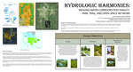
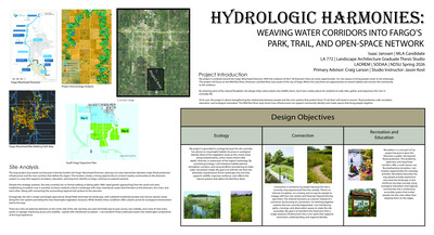
Hydrologic Harmonies: Weaving Water Corridors Into Fargo's Park, Trail, and Open Space Network
Isaac Janssen
This thesis investigates how Fargo’s river corridors can be redesigned as connected, multi-functional public landscapes that strengthen community access, expand recreational opportunities, and support nature-based education. Although the Wild Rice and Red Rivers shape the city’s identity, decades of flood-control infrastructure and fragmented access have limited the public’s relationship with these waterways. As Fargo continues to grow and adapt to changing hydrologic conditions, the need for resilient, accessible, and educational riverfront spaces has become increasingly urgent.
Using a mixed-method approach that integrates literature review, precedent analysis, GIS-based site assessment, and iterative design exploration, this project develops a framework for reconnecting residents to the river through a system of trails, access points, play environments, and ecological learning zones. Precedents in resilient park design and hillside adventure play inform strategies for shaping topography, managing flood dynamics, and creating immersive educational experiences within the floodplain.
The resulting design proposes a connected river loop that links neighborhoods, enhances recreational diversity, and interprets the ecological processes of the floodplain. By combining resilience principles with community-oriented programming, the project demonstrates how riverfront landscapes can function simultaneously as infrastructure, public space, and outdoor classroom. The thesis contributes a replicable model for cities seeking to transform flood-impacted corridors into resilient, engaging, and educational public landscapes.
-

Cooling Washington Avenue: A Guide to Urban Heat Island Effect Mitigation for Detroit Lakes, MN
Nathan Johnson
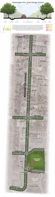
This thesis explores the redesign of an urban corridor in Detroit Lakes, Minnesota. Detroit Lakes is a small urban city characterized by its year-round tourism, vibrant downtown, and sandy beachfront. Like many other urban environments, it faces growing challenges associated with the urban heat island effect, as well as stormwater management and pedestrian safety. To address these issues, this project proposes integrating green street design strategies to mitigate the urban heat island effect and increase pedestrian safety. Using design principles drawn from four case studies, this project introduces natural stormwater management systems, designated bike lanes, increased canopy cover, and decreased impervious surfaces. Through this redesign, the city of Detroit Lakes gains a more cohesive corridor that connects the downtown to the lakefront in an ecological, comfortable, and safe manner.
-
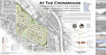
At the Crossroads: Designing for Livability and Community Identity in an Era of Rapid Suburban Growth in Rogers, Minnesota
Reagan Johnson
At the Crossroads explores how landscape architecture can guide suburban growth while strengthening livability, connectivity, and community identity in Rogers, Minnesota. As Rogers continues to expand within the Twin Cities metropolitan region, the city faces challenges associated with suburban sprawl such as limited pedestrian connectivity and the potential loss of local identity. This thesis focuses on a 128.4-acre site near the historic Fletcher crossroads and proposes a landscape-driven design approach organized around historic preservation, walkable public spaces, a parks and open space network, and mixed residential development. Inspired by Garrett Eckbo’s belief that community form results from community design, the project uses landscape as an active tool for strengthening social connection and guiding suburban expansion. By integrating Fletcher crossroads, historic buildings, neighborhood parks, a town center, and a pedestrian greenway system, the project aims to create a more connected, livable, and identity-driven community for the future growth of Rogers.
-
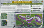
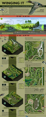
Birds, Bees, + Butterflies: Restoring Suburban Wildlife Homes and Habitats in Bismarck, ND
Elena Joubert
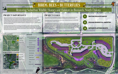
For centuries humanity has been expanding its borders, stretching in and across a wide range of ecosystems, optimizing the land for human use and habitation. Animal-aided design is a possible solution to the loss of habitats; a new methodology of designing green spaces for the use of specific native species. Green spaces are vital to the mental and physical well-being of people, and the presence of native species such as songbirds or butterflies can further increase those benefits. Only 4.2% of North Dakota is developed land, referring to urban and industrial usage, but within these spaces are opportunities to conserve habitats within residential zones. The leading goal of this thesis is to investigate methods of incorporating animal habitats into suburban areas through the renovation of existing builds. The thesis project set three main objectives to lead design development: establish wildlife habitat, retain and provide resident amenities, and enhance the site with a detailed planting plan.
-

Link to Home + Back: A Transit-Oriented Mixed-Use Bridge Between Neighborhood, Nature + the City of Lynnwood, WA
Rushell Paola Martinez Reyes
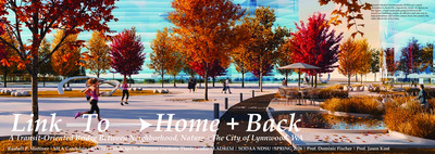
Link to Home + Back: A Transit-Oriented Bridge Between Neighborhood, Nature + The City of Lynnwood, WA. Is a project that seeks to help achieve a better connectivity in an area close to the City Center Station that is currently lacking connectivity in all aspects but, vehicular traffic. This is an important issue to resolve, since with a better connectivity and pedestrian and cyclist circulation the chances of people walking to and from the transit station to make use of it increase dramatically, which eventually helps reduce the pollution produced by vehicles. This research aims to study if transit-oriented development is the appropriate solution to this problem and which type of TOD is the most appropriate for it. The study methodology in this project is comparative case study analysis and the study of TOD index. Specifically Potential TOD index as it was the one the fitted this project the best.
-
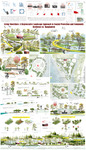
Living Shorelines: A Regenerative Landscape Approach to Coastal Protection and Community Resilience in Bhasan Char, Bangladesh
Anamul Hoque Mojumder
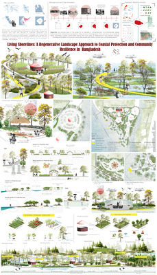
Bhasan Char is a newly formed, unstable silt island in Bangladesh which is home for more than one million Rohingya refugees—an ethnic Muslim minority from Myanmar who have fled decades of systematic persecution and violence—suffering from an ecological and humanitarian crisis. This community faces extreme vulnerability from cyclones and sea-level rise on a landscape of profound precarity.
Traditional hard-engineered defenses are costly, ecologically damaging, and ineffective against the island’s dynamic geomorphology. This research proposes a regenerative "Living Shorelines" model, intersecting coastal resilience with refugee empowerment through Blue-Green Infrastructure. Drawing on successful global precedents in Vietnam and the USA, the study employs a qualitative case study methodology to develop a design framework that embraces natural processes and layered ecological systems.
The primary outcome is an "Island as a System" proposal, synthesizing a protective mangrove buffer with a "Shoreline Stewardship Cooperative." Findings indicate that technical solutions must be paired with social frameworks to be effective. By integrating natural infrastructure with community-based management, this model offers a scalable approach to humanitarian crises. It concludes that designing landscapes to empower displaced communities is the most profound way to achieve lasting ecological, economic, and social resilience in precarious coastal environments.
-
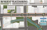
Resilient Placemaking: Enhancing Community Identity, Streetscapes, and Public Spaces in Beaver Dam, Wisconsin
Ellen R. Nampel
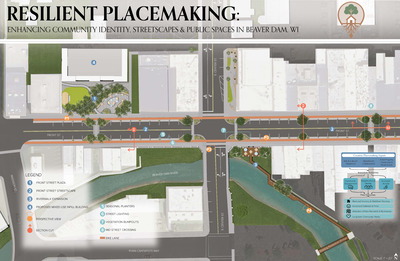
This thesis provides a plan to revitalize downtown Beaver Dam, Wisconsin, by improving its public spaces. While the downtown is currently stable, this research proactively addresses future risks like economic decline and the loss of local identity. By combining placemaking with urban resilience strategies, the study shows how better street designs can bring people together and support local businesses. The proposed design focuses on three goals: turning empty lots into flexible event spaces for community gatherings, making streets safer and easier to walk by reducing car dominance, and using local branding to celebrate the city’s history. These changes aim to create a vibrant, inclusive environment that is better prepared for future challenges while ensuring the downtown remains the social and economic heart of the community.
-

Temporality Waters: Connecting People to the Brays Bayou Through Memory, Culture, and Identity Experiences in Houston, Texas
Khulda Aamir Obaid
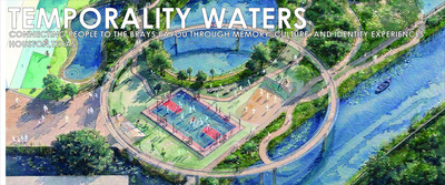
Communities across Texas face increasing hydrological pressures from natural climate variability, changing precipitation patterns, and rapid urban growth. Although directly attributing extreme precipitation events to anthropogenic climate change is complicated by internal variability and observational limitations (de Vries et al., 2023; Griffin et al., 2024; IPCC, 2021; National Academies, 2016), cities such as Houston are preparing for more frequent and intense storms. Historical floods—including Tropical Storm Allison, the Memorial Day and Tax Day floods, and Hurricane Harvey—have exposed the limits of Houston’s predominantly hard-infrastructure flood management. The Brays Bayou watershed, particularly the Meyerland neighborhood, shows heightened vulnerability, where impervious surfaces, engineered channels, and road networks disrupt natural hydrology.
Traditional flood-control strategies rely on rigid, concrete infrastructure, which can accelerate runoff, reduce infiltration, and constrain ecological functions. Drawing on water urbanism and the hydro-social cycle (Mathur & da Cunha, 2014; Spirn, 1998; Linton, 2014), this study proposes an adaptive soft-infrastructure approach that treats water as an experiential and cultural element of urban life rather than solely a hazard. Its novelty lies in combining geospatial hydrological modeling with a design-oriented framework, overlaying soft-infrastructure strategies onto engineered landscapes to enable multifunctional flood adaptation in dense urban areas.
Methodologically, the study uses ArcGIS and SAGA GIS to model surface runoff, watershed connectivity, land-use change, and repetitive-loss patterns across Brays Bayou. (Should I add second step of the research is …) A systematic review of global and Asian soft-infrastructure precedents evaluated strategies on four criteria: (1) hydrological effectiveness, (2) compatibility with dense urban forms, (3) adaptability to existing infrastructure, and (4) cultural or experiential value. Techniques examined include green corridors, bioswales, multifunctional parks, floodable plazas, adaptive streetscapes, canal revitalization, urban terraforming, and multi-level public spaces.
Preliminary results suggest that retrofitting Brays Bayou edges, streets, parks, easements, and other urban areas with multifunctional landscape systems can slow runoff, increase infiltration, and partially restore historic floodplain behavior without extensive land acquisition. Strategies that visibly integrate water—through connected green corridors, adaptive streetscapes, and floodable community spaces—show the greatest potential. Constraints include narrow rights-of-way, incompatible grades, underground utilities, limited soil and vegetation space, public acceptance, and maintenance demands.
These findings are applicable to other U.S. coastal and flood-prone cities, demonstrating that soft infrastructure can simultaneously achieve ecological, hydrological, and social objectives. Future research may involve long-term monitoring, development of transferable design frameworks, and deeper integration of community engagement to ensure culturally grounded, resilient, and sustainable solutions.
-
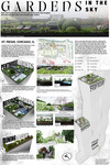
Gardens in the Sky: Rooftop Landscaping Design in the Chicago Downtown Environment
Noah Olson
Cities around the world are becoming increasingly more susceptible to heat, largely due to the urban heat island effect (UHI). Green roofs, which essentially turn building tops into planted gardens, can be an effective and creative way for landscape architects to combat these problems. This thesis will use a literature review of peer-reviewed studies to examine green roof materials, designs, and performance in reducing UHI impacts and stormwater runoff. Findings show surface temperature reductions of 20-30°C, air cooling of 1-2°C, and 17-51% runoff retention. These results have been applied to redesign three terraces at the St. Regis Chicago: the 11th-floor Dining Gardens, 47th-floor Residential Gardens, and 71st-floor Penthouse Gardens.
-
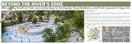
Beyond the River's Edge: Reimagining Riverfront Parks and Landscapes for Stormwater, Flood Resilience, and Public Spaces in Fargo, ND
Moumita Roy
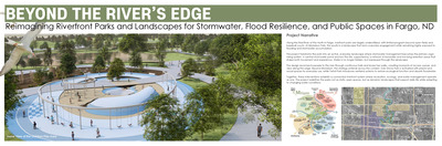
Riverfront parks play an important role in managing stormwater, reducing flood risks, and improving ecological resilience in flood-prone cities. In Fargo, North Dakota, the Red River corridor functions as both a recreational landscape and a critical floodplain system, yet the stormwater and flood performance of these parks has not been systematically evaluated. This study developed a GIS- and hydrologic modeling–based framework to assess the landscape performance of Fargo’s riverfront parks and explore design strategies for more resilient public spaces. Using ArcGIS Pro, remote sensing, DEM analysis, field observations, and InfoWorks ICM simulations, the research identified runoff accumulation zones, flood-prone areas, erosion risks, and ecological connectivity patterns under different storm scenarios. The findings informed evidence-based design interventions, including wetlands, bioswales, riparian buffers, and adaptive public spaces that integrate flood resilience with recreation and ecological enhancement. The study provides a replicable framework for reimagining riverfront parks as multifunctional landscapes that support both environmental performance and everyday public life.
-
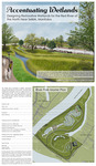
Accentuating Wetlands: Designing Restorative Wetlands to Clean the Red River of the North Near Selkirk, Manitoba
Grace Stein
Research was conducted looking into how wetlands clean water with a focus on nutrient removal through plant uptake, sedimentation, and absorption. Additional research was done to determine the methods of constructing a wetland. This thesis focuses on improving water quality for the Red River of the North by intaking 720,000 gallons of water per day out of the river and treating it for different agricultural runoff pollutants. This is achieved by using a series of constructed wetlands, each designed to remove a specific nutrient from the water. After nutrients have been removed, the water will be pumped back into the Red River of the North.
-

Beyond the Green: Creating Positive Outcomes From Unfortunate Scenarios
Caden Allen
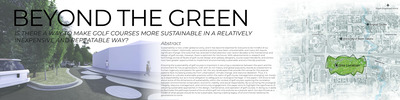
This thesis explores sustainable design strategies for golf courses, focusing on reducing environmental impacts through landscape management. Using case studies from Rivermont Golf Club and Memorial Park Golf Course, the research looks into the successful approaches in organic soil management, water conservation, and habitat creation. The findings highlight the importance of reducing the total amount of maintained turf areas, creating water reuse systems, and enhancing biodiversity through native plantings. These findings are then applied to the redesign of Ray Richards Golf Course, where a combination of native grasses, retention basins, and improved site features demonstrates the potential for sustainable golf course transformations. This project emphasizes that sustainability in golf course design is not only achievable but also beneficial for the health of the surrounding ecosystems and the overall player experience.
-
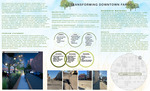
Transforming Downtown Fargo: Designing Green Streets for a Sustainable Future
Taylor Bay
Downtown Fargo, North Dakota’s streets are mostly concrete and asphalt, which means when it rains, water runs off, causing flooding. The area is heavily car-focused, making it tough for pedestrians and cyclists to navigate comfortably. There is a lack of protection from the elements as well as a lack of seasonal interest in the area. This project tackles these issues by designing a green street along First Ave N that integrates stormwater management, circulation improvements, and seasonal elements. The goal is to create a more sustainable, walkable, and visually engaging space that connects to Fargo’s identity.
The design uses bioswales, green roofs, and cisterns to catch and filter runoff, keeping water on-site longer and reducing the risk of flooding. Widened sidewalks, protected bike lanes, and raised crosswalks make streets more walkable. Public art, created by NDSU students and rotated each semester, adds seasonal interest and a sense of local character.
Methods included site analysis, research, and case studies focused on making the space adaptable to Fargo’s drastic winters and hot summers. The proposed design helps manage stormwater and circulation but also creates a more engaging, community-focused streetscape that can change and evolve over time.
-

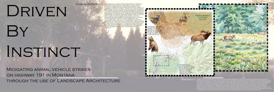
Driven by Instinct: Mitigating Animal Vehicle Strikes on Highway 191 in Montana Through the Use of Landscape Architecture
Zachary J. Blum
Animal vehicle strikes on highways pose a significant threat to wildlife and human safety, resulting in the degradation of ecological corridors, injuries, death, and economic loss. This thesis explores the use of landscape architecture, in mitigating animal vehicle Through literature review, wildlife migration and movement patterns, I ultimately developed a wildlife corridor design scenario to mitigate the conflict between humans and wildlife on, U.S. 191 in Montana and reduce the quantity of animal related strikes on this highway corridor from Bozeman to Big Sky.
-

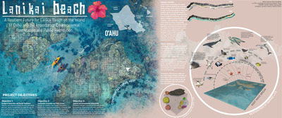
A Resilient Future for Lanikai Beach on the Island of Oahu and the Importance of Environmental Restoration and Public Recreation
Ethan Comeau
Lanikai Beach, Hawaii, a vibrant corridor that seamlessly guides visitors to the shore, enhancing both aesthetics and functionality. The project includes improved street parking to reduce congestion while integrating sustainable stormwater management systems that filter runoff before it reaches the ocean. To combat coastal erosion, I reinforced the seawall and introduced a thoughtfully engineered wave break, incorporating grafted coral reefs to restore marine ecosystems. This innovative approach not only protects the shoreline but also fosters biodiversity, ensuring long-term resilience against rising tides. By blending ecological restoration with urban design, the project harmonizes human access with environmental preservation, creating a lasting impact on both the community and the coast.
-

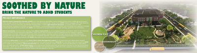
Soothed by Nature: Bring the Nature to the ADHD Students
Dominick Dressler
Attention Deficit Hyperactive Disorder (ADHD) and other learning disabilities make traditional education challenging because it often requires sitting still, following routines, and focusing for long periods, things many ADHD students struggle with. Their need for movement, hands-on learning, and flexible thinking doesn’t match rigid classroom structures. As a result, they can feel misunderstood, leading to frustration and low self-esteem. Incorporating outdoor education and naturalistic play spaces in schools is especially beneficial for students with ADHD, as it supports focus and attention through calming, restorative environments. Nature-based play and education settings help reduce hyperactivity by encouraging physical movement, which in turn improves classroom behavior and emotional regulation. These spaces also provide rich sensory experiences that support cognitive development and help children better process their surroundings. Learning outdoors through hands-on activities enhances engagement and memory retention, especially for kinesthetic learners. Overall, natural environments foster inclusion, creativity, and social growth, offering students with ADHD alternative ways to succeed and feel confident. Urban life isn’t the direct and only cause for ADHD, but it needs to be considered. Urban environments can make symptoms worse. Noise, pollution, and over-stimulation in cities affect focus and self-regulation. Limited green space and a fast-paced lifestyle add stress and reduce chances for mental and physical restoration, which are key for managing ADHD and further exacerbates learning difficulty in the classroom. Bancroft Elementary is in the suburbs of Minneapolis and has several students that live directly in the city.
-

Designing for Diaspora: A Culturally Inclusive Landscape Celebrating Filipino Heritage in Winnipeg, MB
Oakley Gray
Winnipeg, Manitoba, has a diverse population and a special relationship and rich history with the Filipino community and the Philippines. Filipinos have supported Canada through economic and cultural contributions, such as working as medical experts or contributing to political milestones. Contemporary parks and open spaces often do not represent minority communities and their contributions to society. The goal of this thesis is to create an open space, characterized by plazas, pedestrian corridors, and streetscapes, that acknowledges the Filipino community. Additionally, the goal of the design is to promote interaction and cultural expression through site elements, research of case studies and vernacular Filipino materiality.
-

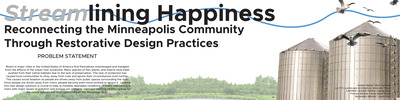
Streamlining Happiness: Reconnecting the Minneapolis Community Through Restorative Design Practices
Ayden K. Highet
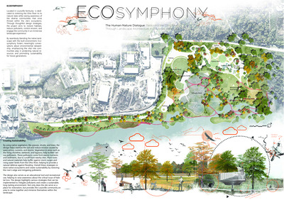
Located in Minneapolis Minnesota, Upper Terminal Harbor is a post-industrial restorative design park. Using restorative design measures, and community connecting techniques, this design aims to bring the community together to connect with people and nature. Furthermore, the use of best management practices to help heal the effects of Urban Stream Syndrome along the Mississippi River shoreline.
-
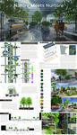
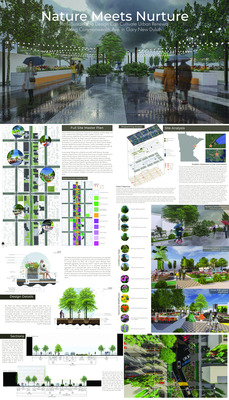
Nature Meets Nurture: How Sustainable Design Can Cultivate Urban Renewal Along Commonwealth Ave. in Gary New Duluth
Katerina Kroska
This project reimagines a downtown corridor in the Gary-New Duluth neighborhood, transforming it into a vibrant, pedestrian-friendly streetscape that fosters community connectivity and economic vitality. Historically defined by the rise and fall of the U.S. Steel Duluth Works plant, the area has struggled with fragmented land use, low-density development, and vehicle-dominated streets. In response, the design introduces a multi-layered public plaza system that activates underutilized spaces, creating a network of walkable, human-scaled environments. Curvilinear streets slow traffic, enhancing pedestrian and cyclist safety, while green infrastructure promotes ecological health. Inspired by Jan Gehl's principles of protection, comfort, and delight, the corridor features active edges that support social interaction and local commerce. By integrating safe crossings, transit access, and compact blocks, the project reduces vehicular reliance and fosters a sense of place, aiming to reinvigorate Gary-New Duluth as a connected, resilient, and inclusive community.
Printing is not supported at the primary Gallery Thumbnail page. Please first navigate to a specific Image before printing.